Nanxingdu District — A Plan for Livable Streetscapes
August 31st, 2021
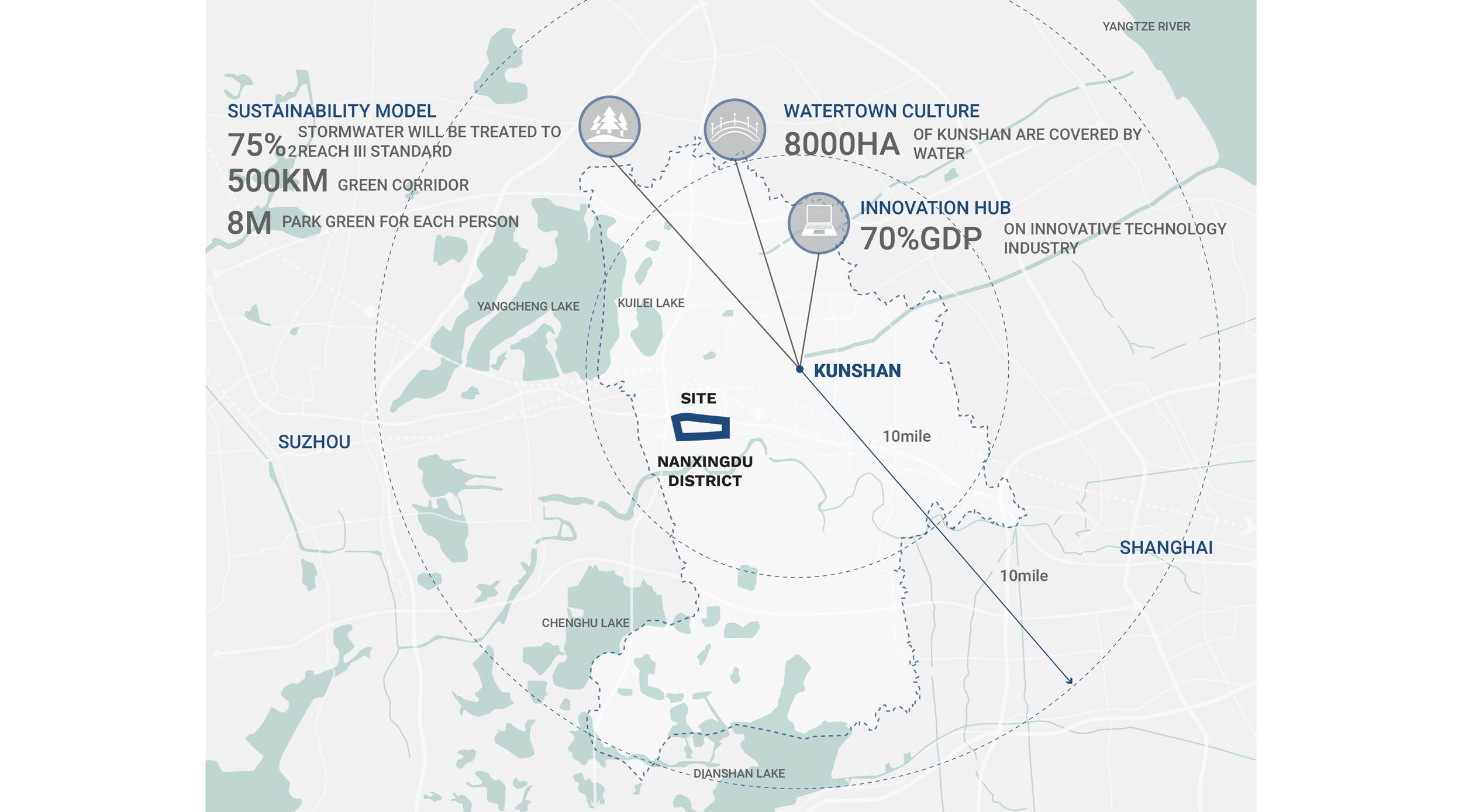
Kunshan, China
DISTRICT CONTEXT
Nanxingdu is a district in southwest Kunshan, China currently undergoing a transformation from a heavily industrialized area to a more well-rounded residential community. Experiencing rapid growth in Kunshan during this modern time of tech research and development, the district of Nanxingdu has a rising population of residents who have recently moved to the area to work in the surrounding factories.
SITE CONDITIONS
The existing site is currently developing in an accelerated way to handle the influx of people living there. New commercial centers, schools and medical centers are being built to provide public amenities for the neighborhood, all linked by extensive streetscape and a connected canal system. The evolution of the public realm has the opportunity to support the community needs at ground level and create an environment that is inclusive, social and sustainable for all who live there.
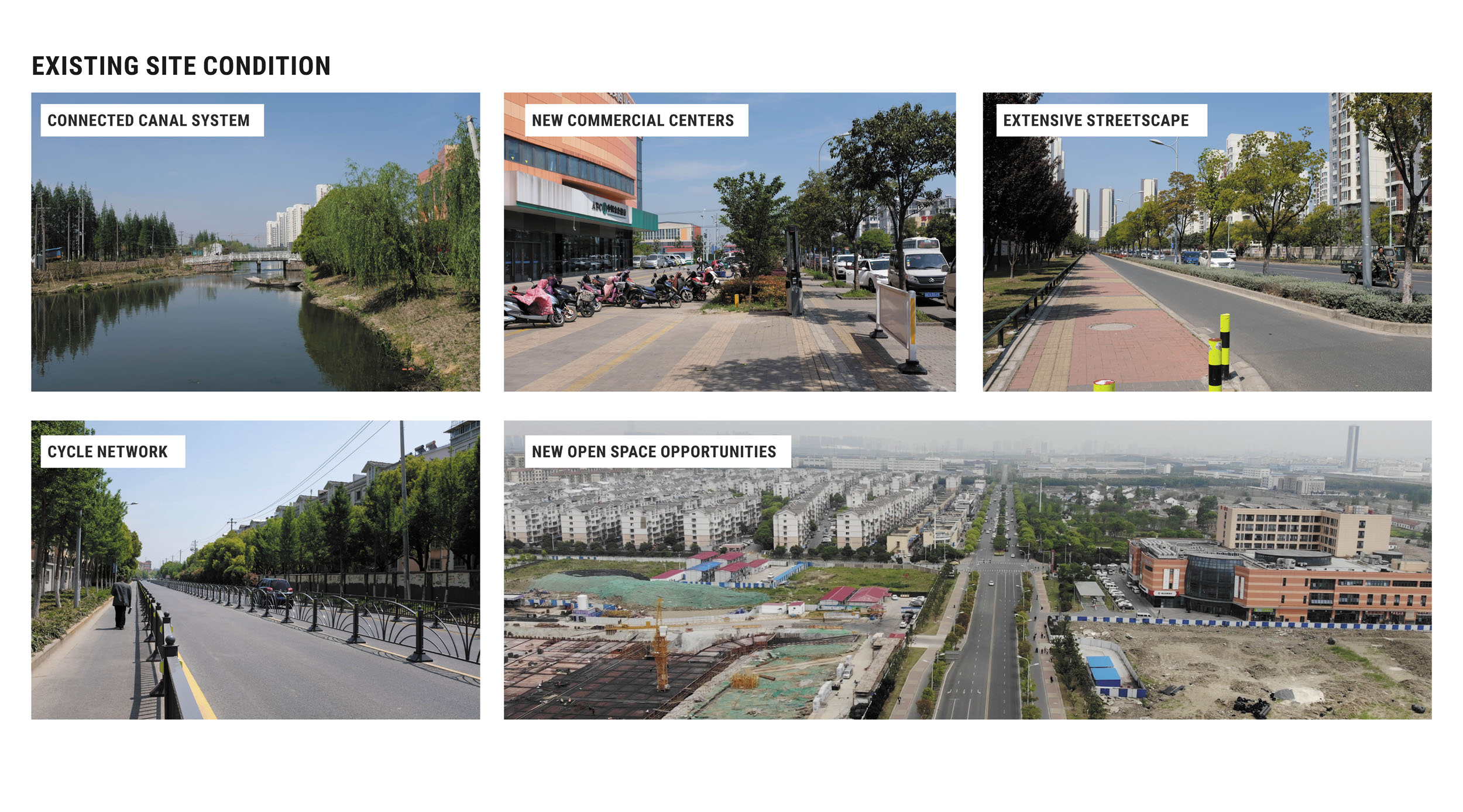
The current amount of available open space of the district requires strategic consideration for landscape improvement in the district core. Contrastly, abundant open space on the edges of the district is vacant and available for implementation and can be used as a major landscape resource for the community. These opportunities were identified, analyzed and incorporated into the landscape framework strategy.
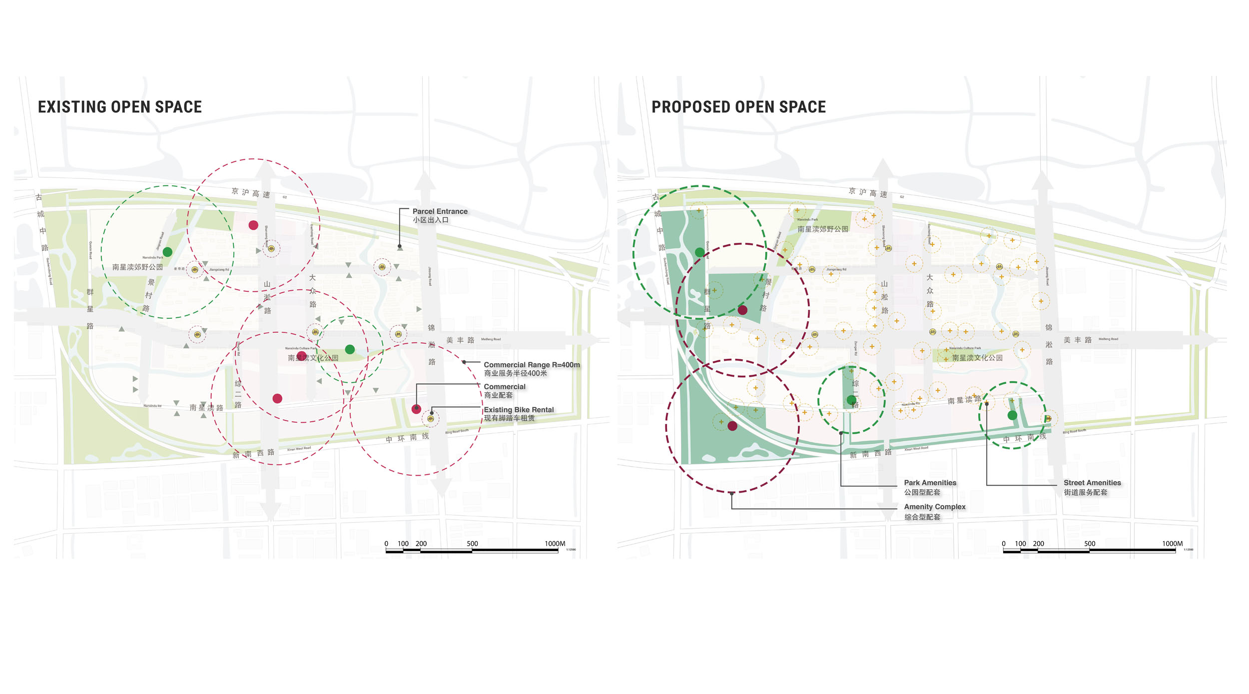
OPEN SPACE VISION
Nanxingdu’s open space framework combines the canal and street systems of the district to form two open space loops that are used to identify where landscape improvement can be implemented. This framework aims to provide livable streetscape and open space for residents who will live, work and play in the inner and outer loops of the Nanxingdu neighborhood.

MASTERPLAN
The Nanxingdu District Masterplan envisions an urban framework that centers the community’s need for convenient open spaces. Reimagining streetscapes and intersections to create parklets and plazas, the open space framework utilizes the entire public realm. Along these improved corridors, nodes in the streetscape and along canals will provide ample space for community gathering and social activities. Greening streets and plazas will soften urban spaces and provide natural amenities for those living in the district.

STRATEGY OVERVIEW
After analysis of the district’s open space, specific sites within the masterplan were used to enact a ripple effect of change across the district as a whole. This type of Ripple Urbansim introduces strategically positioned landscape improvement into an already developed area to make the biggest impact possible on the entire neighborhood.

Three main landscape strategies were used to select targeted locations for prioritized landscape implementation. These strategies focus on developing livable streetscape that is safe and activated for people moving at street level, adaptive nodes that serve the social community and contribute to a recognizable district-wide identity, and comprehensive green infrastructure in all areas of the public realm.

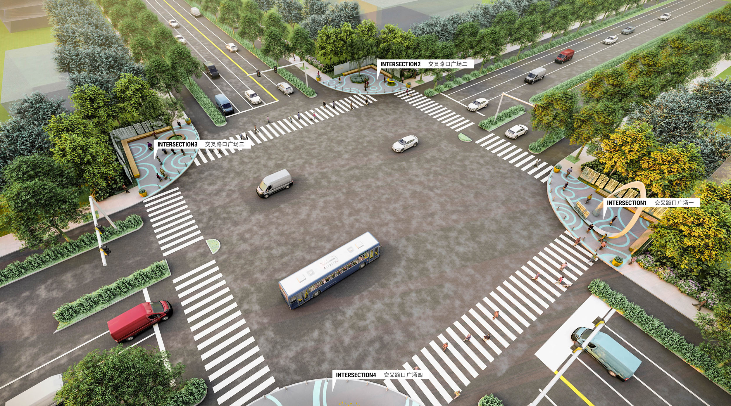
STRATEGY 1 - LIVABLE STREETSCAPE
The district street framework aims to activate streets and intersections by designing a hierarchy of character based on width and size of roadways and intersection corners. Adapting to the number of lanes and available width of streetscape, the framework connects sidewalks, adds parking and prioritizes separated bike lanes to create a comfortable and connected district. Addressing the current state of empty streetscape, the design provides rest areas, amenity kiosks, bike parking, shaded sidewalks and vibrant wayfinding.


The intersections within the district street framework act as social hubs. Providing clean and energized plazas around public services, these active intersections encourage engagement and contribute to the overall district identity with colorful paving and vibrant features.
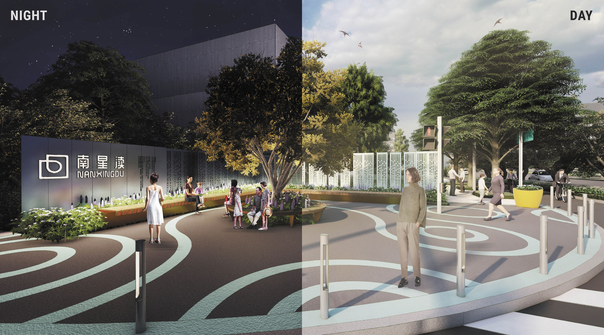
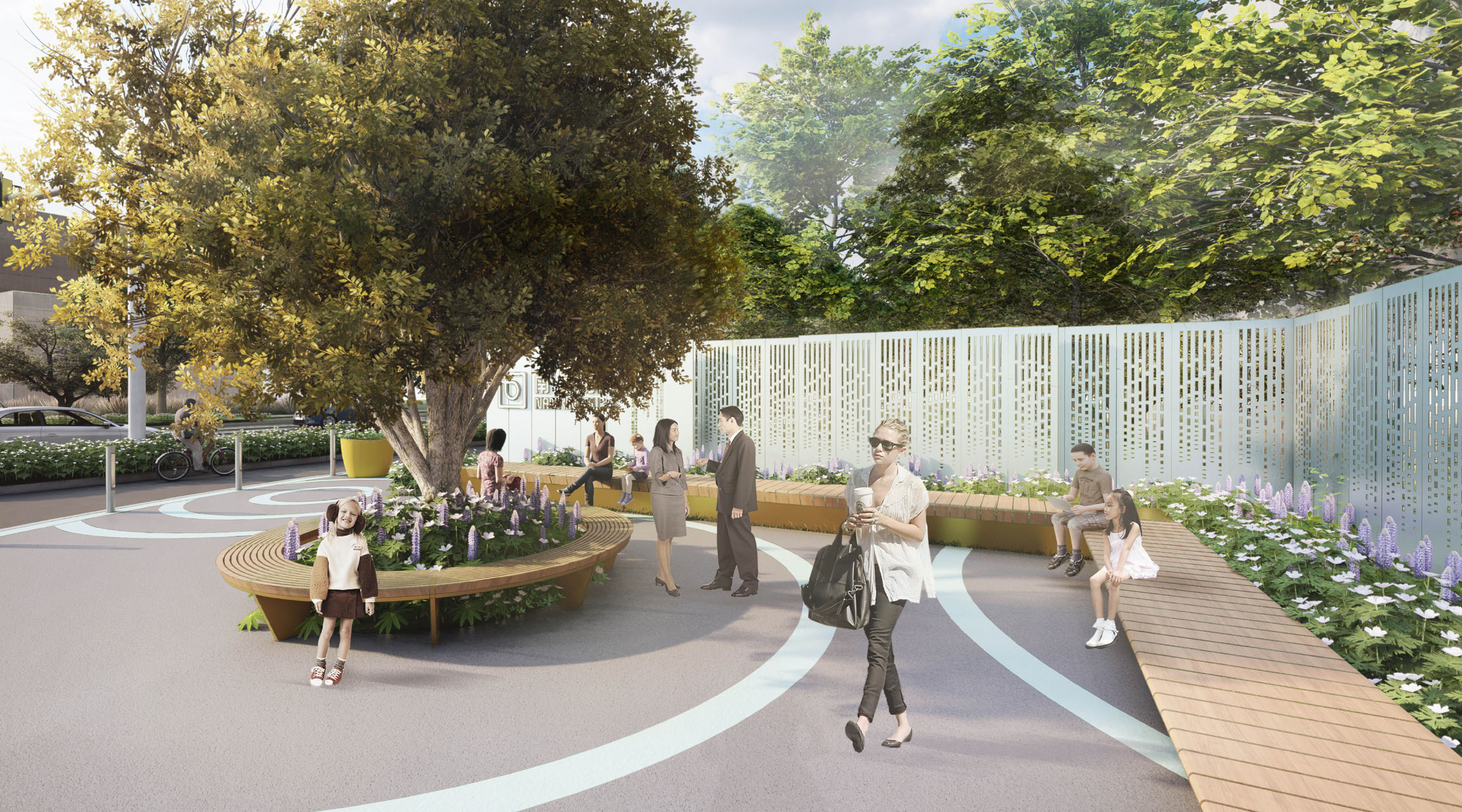
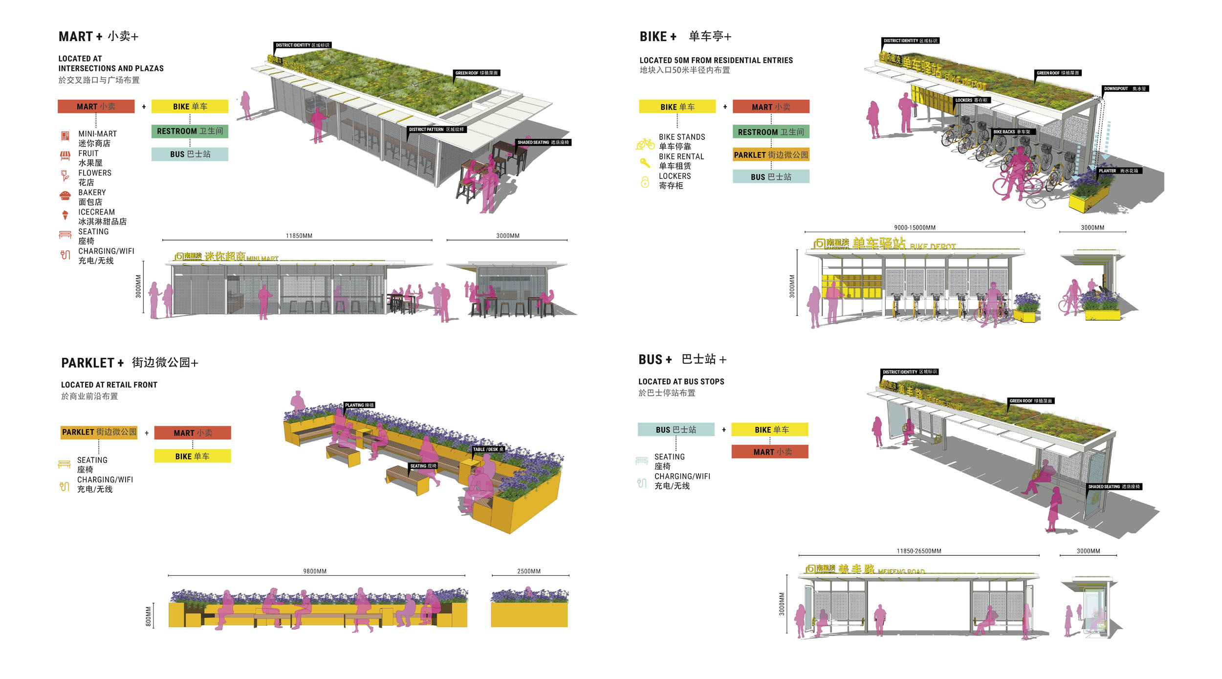
STRATEGY 2 - ADAPTIVE NODES
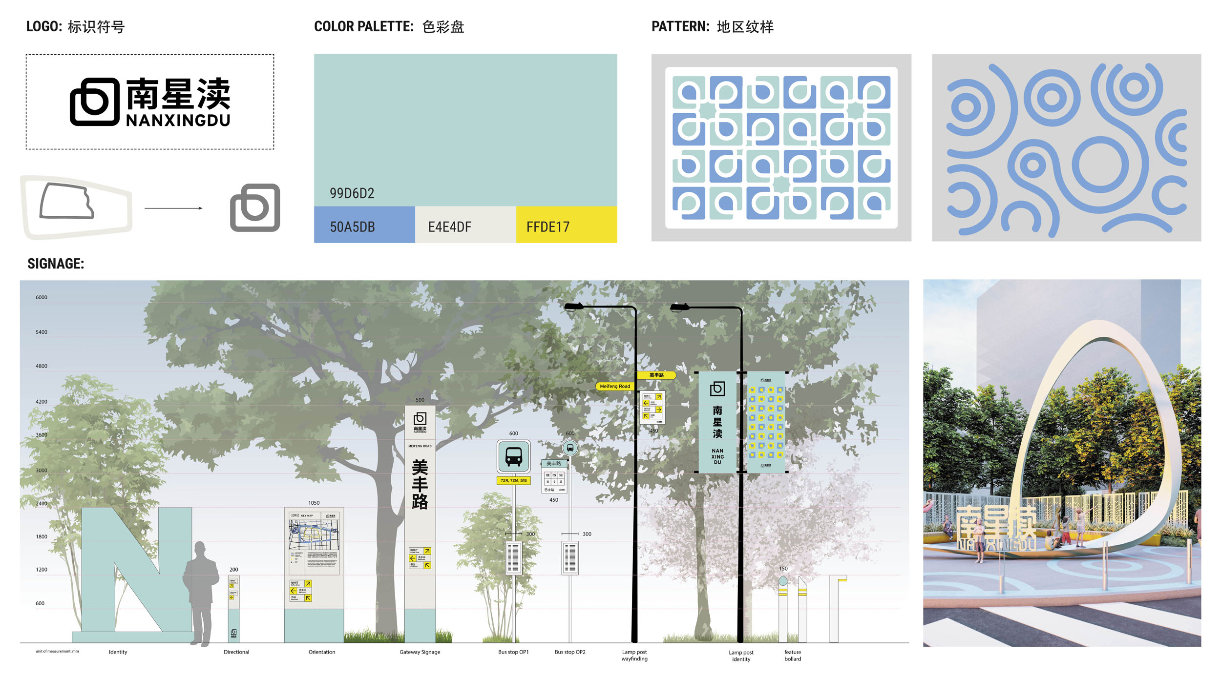
A range of different types of nodes were designed to fit into various conditions along the streetscape, each with a different serving radius ensuring that public realm amenities are accessible for the whole community. These adaptive nodes included mini-mart kiosks, bus stop rest areas, parklets and bike rental stations, each designed with recognizable features based on a district-wide identity scheme of color palette, logo and patterns.
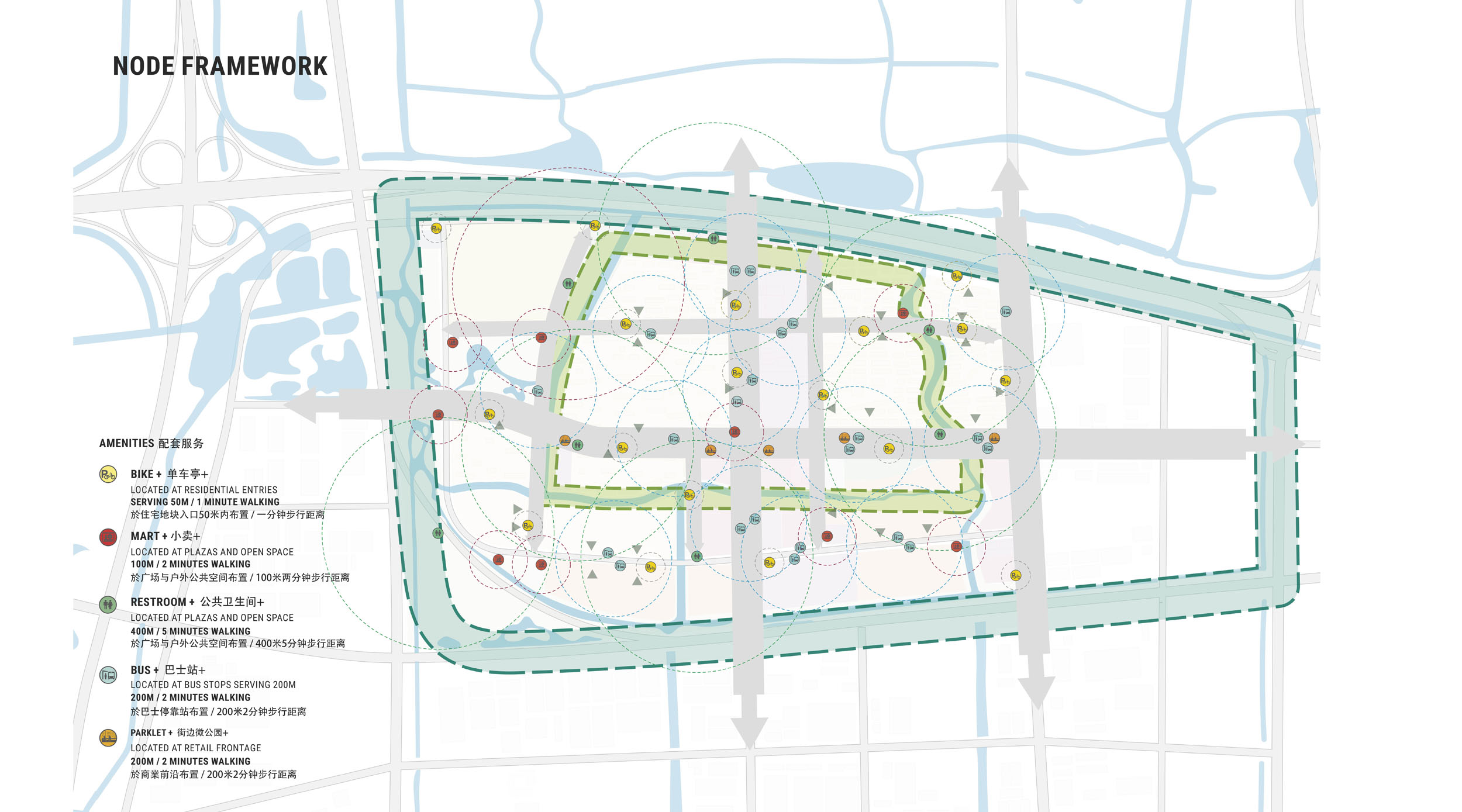
Bike nodes were placed near residential entries to give people immediate access to the cycle network, while Mart nodes provided food and beverage amenities at intersections and plazas along the streetscape. Parklet nodes offer social and resting areas at retail fronts and Bus nodes complement bus stops with clean and comfortable seating opportunities for people waiting for public transportation.


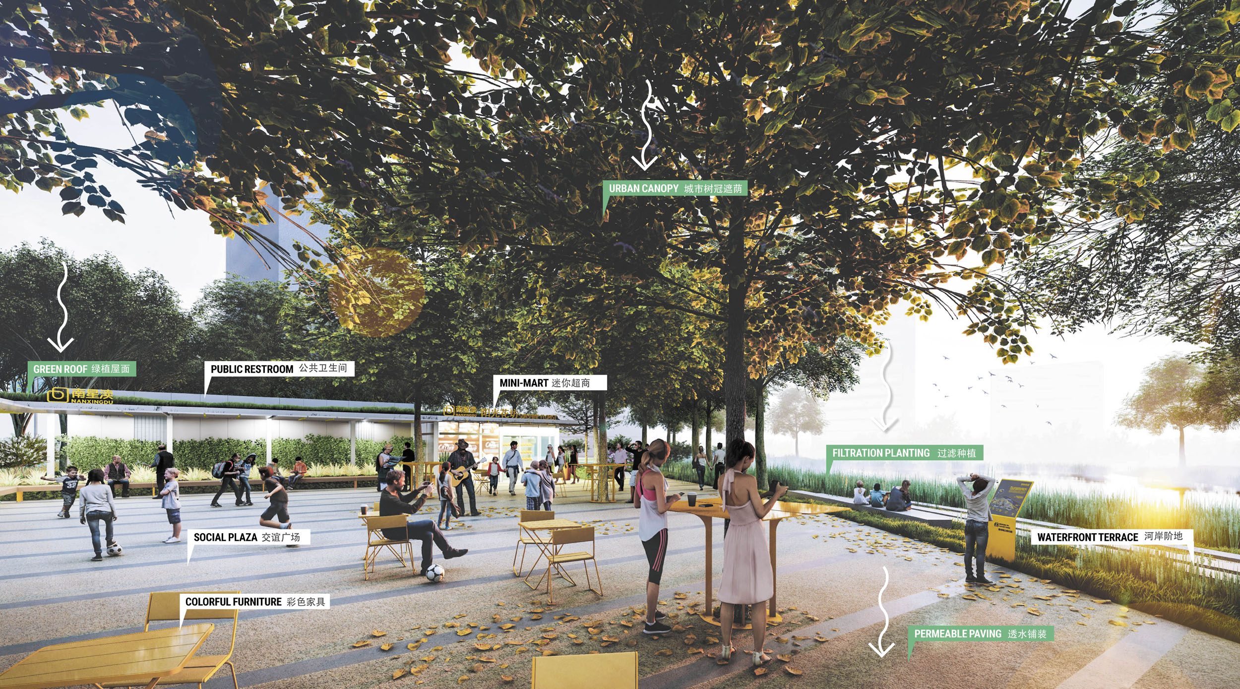
STRATEGY 3 - GREEN INFRASTRUCTURE
The green infrastructure strategy of the district focuses on improving all areas of the public realm, primarily the connected canal system, by implementing sustainable materials and planting into landscape site design. Permeable paving, planted canal slopes, green roofs, and increased urban canopy all help to control the stormwater run-off in hard paved areas and improve the overall ecological health of the district.


STRATEGIC IMPLEMENTATION
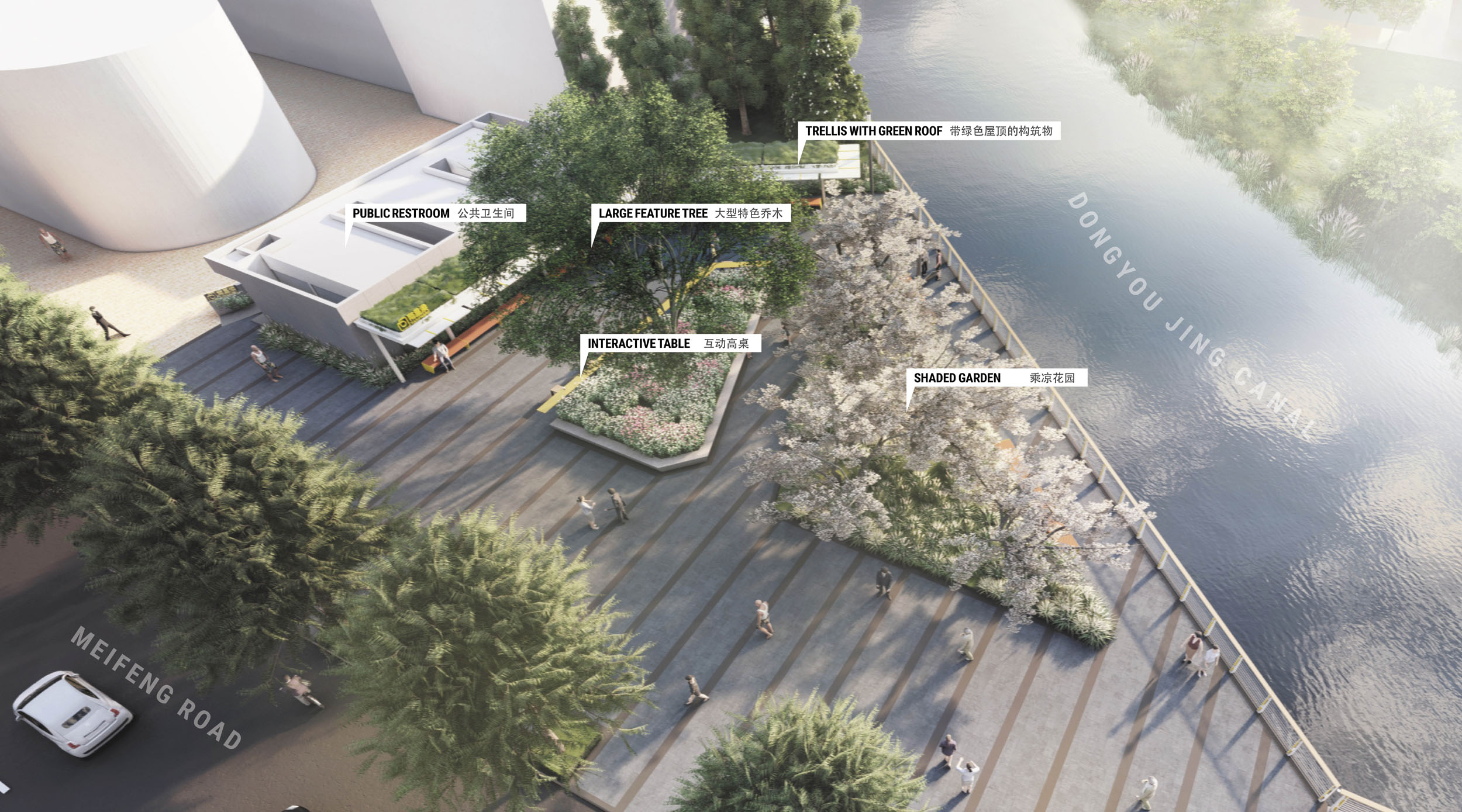
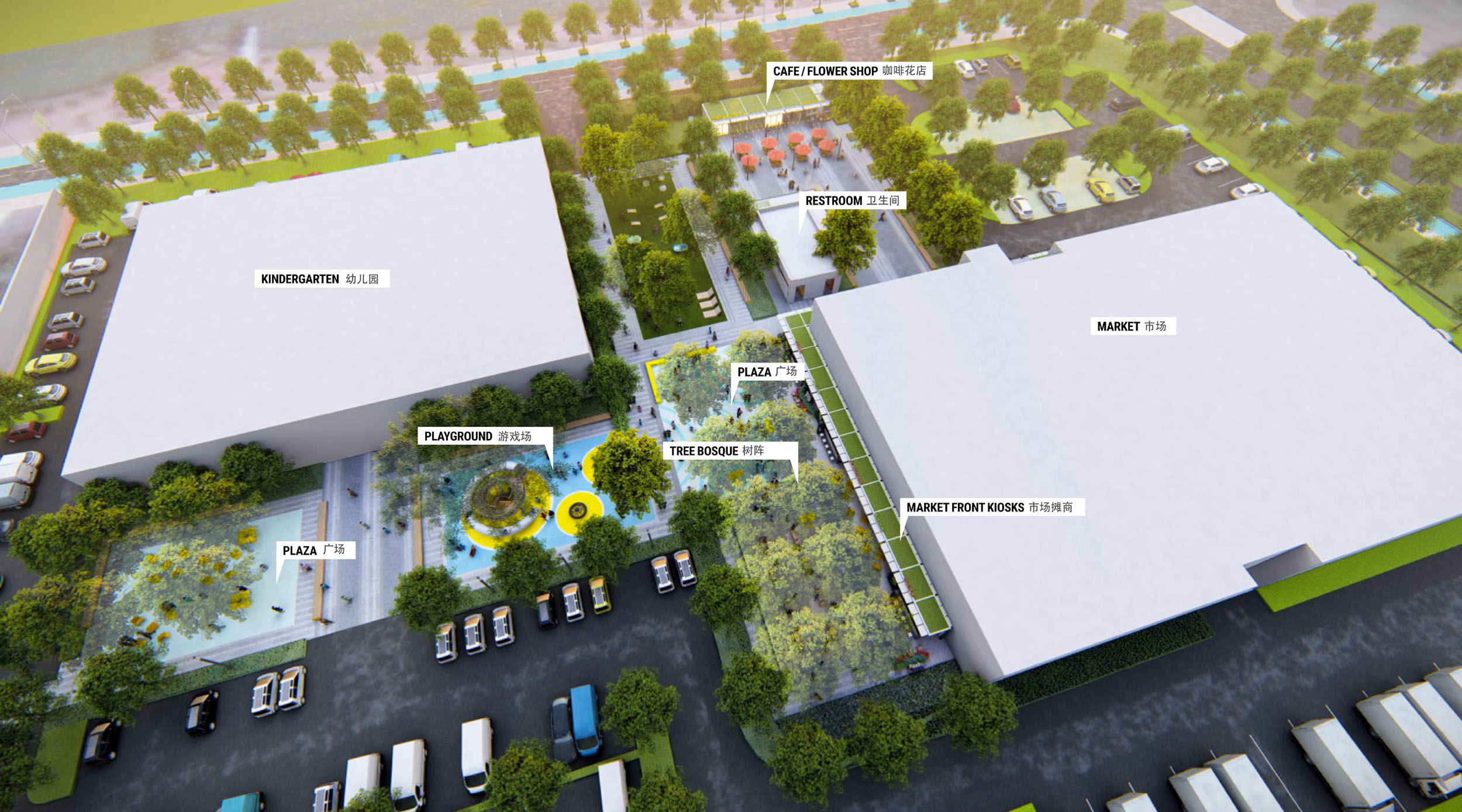
Five targeted sites were selected and prioritized to have the biggest impact on the whole landscape masterplan. The design intention is to initiate a ripple-out effect of change in the district over time. The first site chosen for landscape implementation was the Social Waterfront Court at the intersection of Meifeng Road and Dongyou Jing Canal.

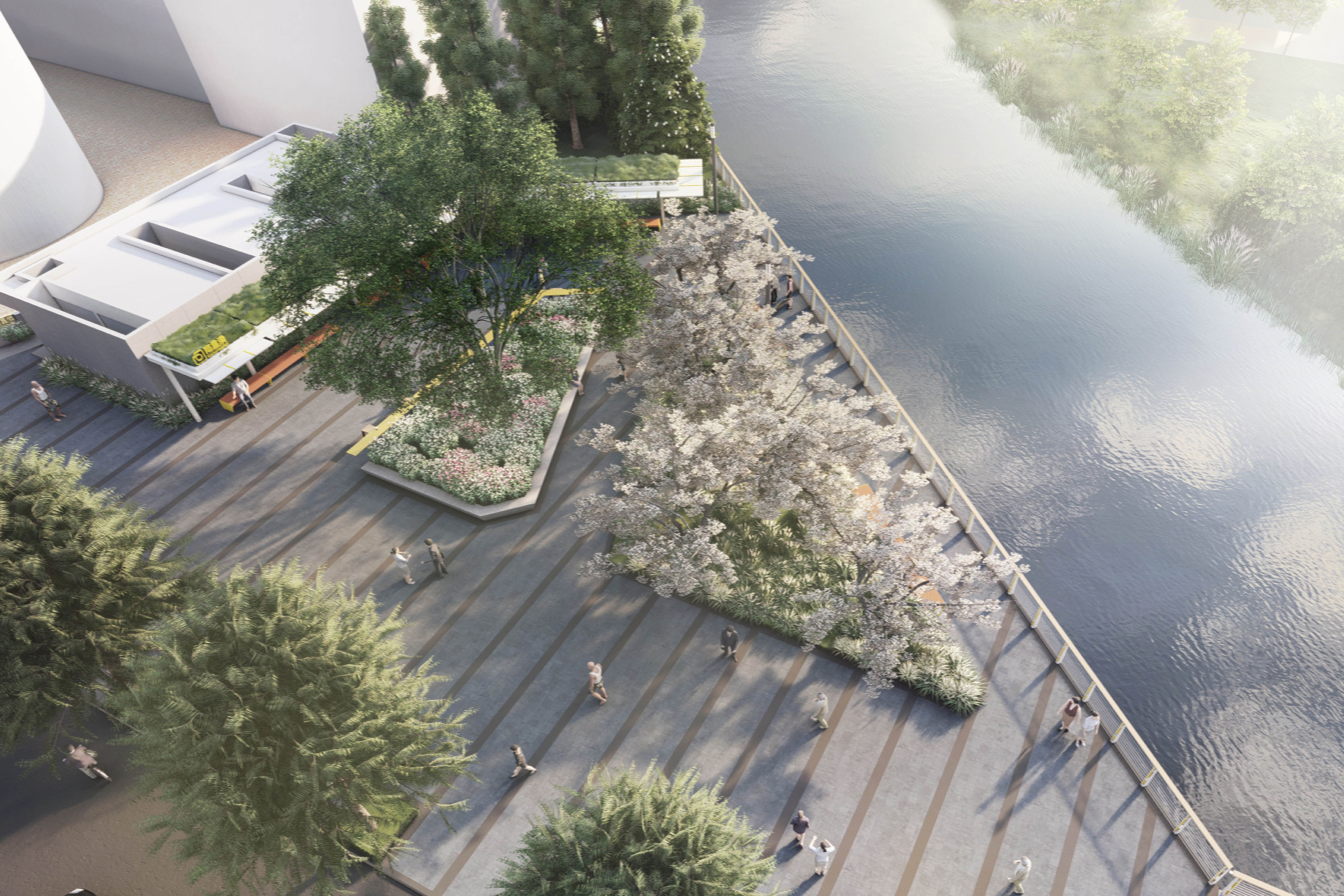
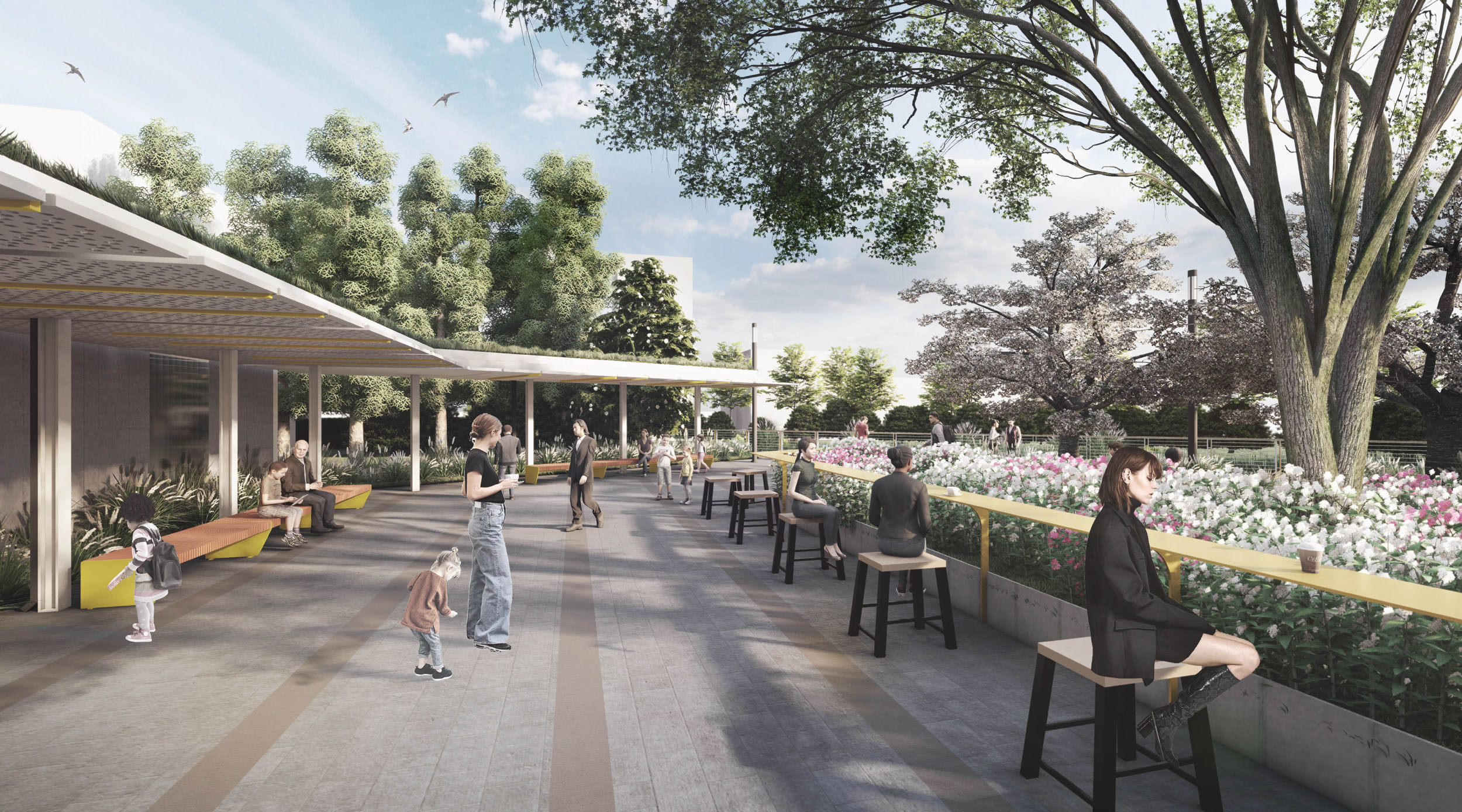
SOCIAL WATERFRONT COURT
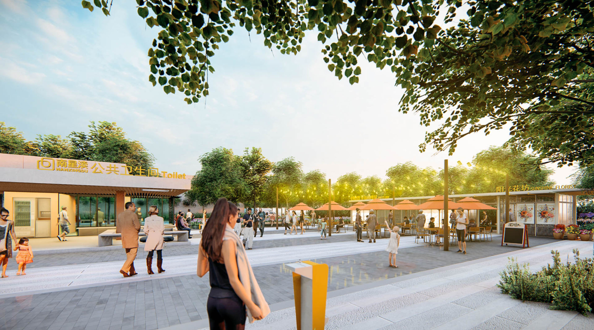
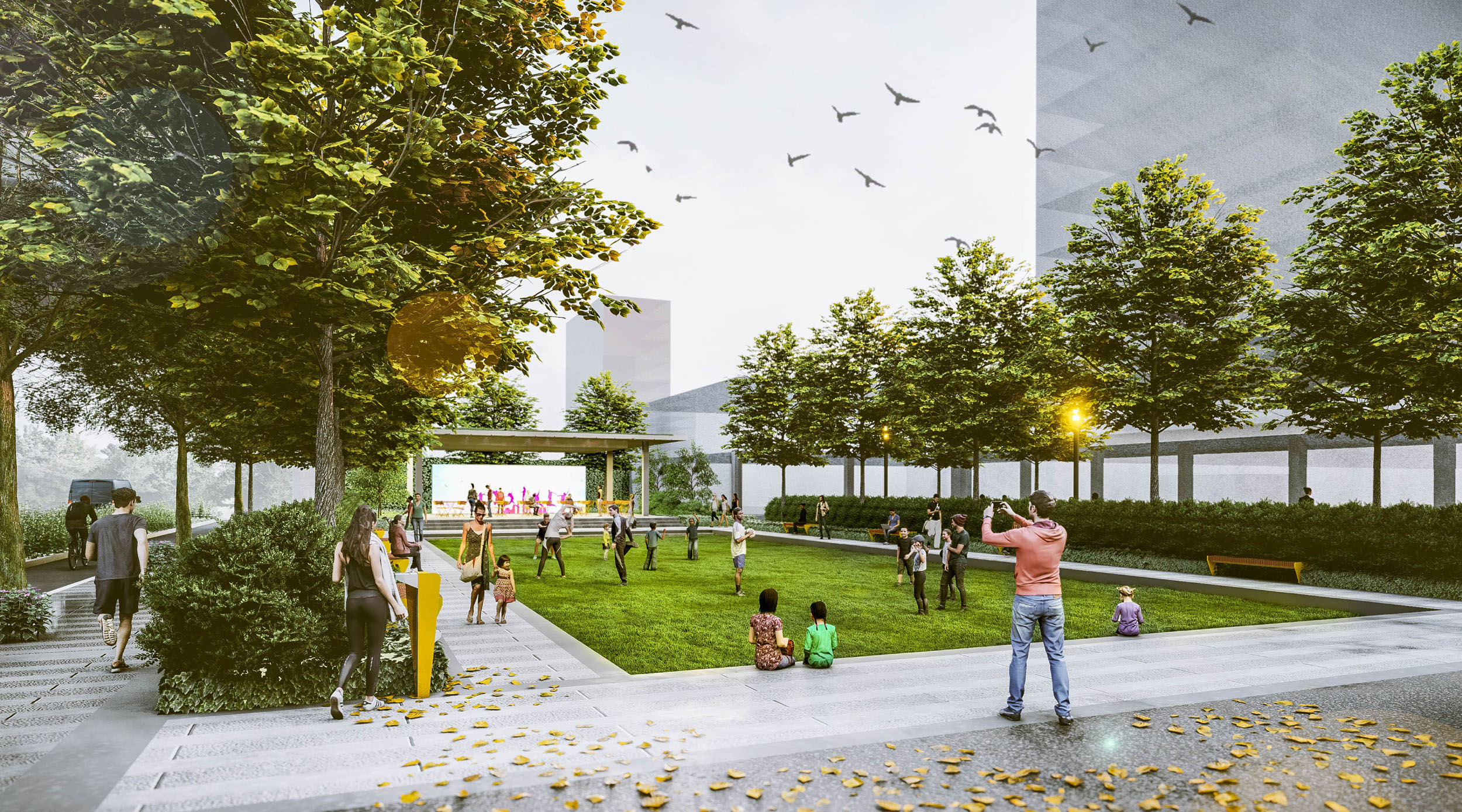
The Social Waterfront Court is a small waterfront node housing a public restroom that provides ample and lushly planted space for people to wait, socialize and enjoy the waterfront views. A large shade structure lines the plaza and looks out towards the shaded gardens and the waterfront. A long raised table is embedded in a grand planter that showcases lush planting and a seasonal feature tree. The design intention of the plaza is to be a clean and vibrant space for the residents to enjoy as an outdoor living room and improve the liveliness of Meifeng Road.


The Social Waterfront Court finished construction in April of 2021 and is now open to the public. The social and environmental impact of this site on the overall district is already being made apparent in the way residents are using it for outdoor gatherings and the improved drainage of rainwater for this corner.

ADDITIONAL PROJECT DRAWINGS


 Project portfolio here